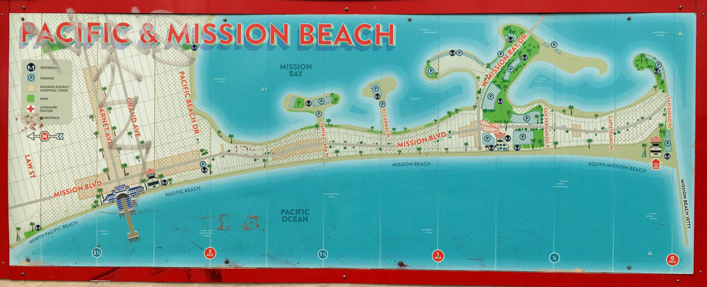
This is a new map posted recently that shows a Map of Mission Beach Boardwalk from Pacific Beach to South Mission Jetty. It shows all the courts and streets in Mission Beach. Including the various coves on the bay coves and attractions to see along the way.
You can also easily measure the distance of mission beach by using this map, to plan for a bike around the bay or a run.
Enjoy exploring the beach!

[…] Quote from the source: … […]
Comments are closed.